AGRICULTURE
Led by geospatial innovator Roman Kathofer, Canadian-based Frontier Geomatics specializes in developing tailored airborne and mobile mapping solutions to meet some of today's most intensive, unique and challenging projects from tracking high voltage power lines to mapping wildfire hotspots.
Kathofer says, “Every customer has a unique set of challenges and requirements. We don't provide turnkey solutions-we develop optimized, tailored hardware systems that mesh with existing equipment, expertise and processes. We try to make it all fit within the designated budget while meeting our customer's short and long-term mapping objectives.”
In the following, Kathofer provides insight into how he and his team match Global Navigation Satellite System (GNSS) plus Inertial Navigation System (INS) solutions with today's wide range of camera systems to achieve cost effective, highperforming navigation solutions.
Integrating LIDAR systems, film and digital cameras, GNSS receivers and Inertial Measurement Units (IMU) as well as flight management systems into a seamless mapping solution-within a reasonable budget-isn't something that can be bought off-the-shelf or pulled out of a box.
Most airborne mapping specialists have compiled their favorite cameras, sensors and flight systems from multiple manufacturers.
These experts look to Frontier Geomatics to integrate their existing and new hardware systems (or to recommend new hardware) with advanced accuracy/positioning technology to improve operational processes and/or data workflow. A key part of Frontier Geomatics customized solution fit is the modular SPAN® positioning and attitude measurement system, which includes a deeplycoupled GNSS receiver with an IMU.
The challenges associated with combining a GNSS+INS system with an aerial camera are many-and flexibility is imperative. Kathofer says, “Every installation is different; there is no cookie cutter solution. The wide performance range of NovAtel solutions allows me to focus on the best fit installation for just about any customer.”
Complementing GNSS with inertial measurements, provides more robust and more accurate positioning in challenging conditions where GNSS alone is limited, and offers continuous position and attitude output. The deep coupling of GNSS with inertial technology provides demonstrable benefits of faster satellite re-acquisition and faster re-initialization after outages, such as steep turns. Also, the ability to post-process GNSS and inertial data with NovAtel's Inertial Explorer® software provides additional tools for the user to improve upon the accuracy and integrity of the combined solution.
Every project requires installation and training and then front line field support. Factors to consider for every installation include the type of flight system, existing equipment, space available in the plane, the type of camera, and of course, cost.
Most customers have invested heavily in cameras, sensors and flight systems. They want to reuse those solutions as much as possible even as they expand on their mapping capabilities. Kathofer adds, “Most don't want or need to replace everything in their suite of hardware.”
The first step is to understand the customer's intended application and associated precision parameters, existing equipment and, especially, the aircraft.
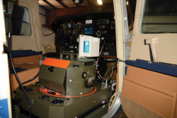
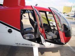
Frontier Geomatics has a South American customer who sought the benefits of a GNSS+INS system to work with a Hasselblad medium format camera to support power line mapping. The system had to stow under the rear seat-cover of the Robinson R44 helicopter.
The customer opted for the NovAtel SPANSE GNSS receiver with FSAS IMU. The IMU-FSAS™ is a tactical grade IMU from iMAR GmbH. With low noise, stable accelerometer and gyro sensors, the IMU is wellsuited to the power line mapping surveys that the company performs. IMU measurements are sent from the IMU-FSAS to the GNSS receiver where a blended GNSS+INS position, velocity and attitude solution is generated at up to 200 Hz.
“In this case, the the IMU-FSAS. is a little too much performance for the low-altitude power line mapping application,” recalls Kathofer. “However, the client chose the higher end FSAS IMU because of its flexibility to move between a medium format and large format camera ad needed to meet other mapping needs.”
For another customer, Blue Skies Consulting in Belen, New Mexico, Kathofer selected two NovAtel SPAN receivers for use with two different cameras for different purposes. The customer specializes in digital photogrammetric and remote sensing data for mapping and surveying applications.
The firm uses Microsoft/Vexcel UltraCam Lp digital camera integrated with the Track Air flight management system, a Leica Geosystems PAV30 gyro-stabilized camera mount, and a NovAtel SPAN-SE receiver with a Northrup-Grumman LN-200 IMU. The SPAN receiver is used to automatically and accurately correct for crab angle as well as photogrammetric processing.
Kathofer says, “In the old days, the operator would have to adjust for cross winds manually. The SPAN technology provides data to make the drift correction automatically.”
The modular nature of SPAN products is also invaluable. Having separate GNSS and IMU enclosures, allows the IMU to be mounted at the most suitable location, while the GNSS receiver is mounted where it is most convenient.
The customer also uses the SPAN-CPT™ receiver with its large format RC30 film camera in a Cessna C210 to correct for crab angle. SPANCPT is a compact, single enclosure GNSS+INS receiver capable of delivering up to centimetrelevel accuracy. The IMU components, within the SPAN-CPT, include Micro-Electromechanical System (MEMS) accelerometers-a key development in recent years that is helping airborne mapping specialists take advantage of GNSS+INS systems.
In fact, MEMS IMU accelerometers and gyroscopes integrated with GNSS+INS systems are ideal for embedded navigation and mapping applications.
Kathofer says, “Not long ago, the possibilities of GPS/IMU combinations were much more limited. The MEMS IMUs didn't provide enough accuracy as compared to the bigger high-performance IMUs with fiber optic gyros. That's not really the case anymore. The industry has come a long way in the performance of small IMUs over the years. The medium performance sensors have a great price/performance ratio and work very well in terms of accuracy for a wide range of applications.”
A MEMS GNSS+INS navigation system can be embedded with a range imaging of sensors without having to spend a huge amount of money, as they would for comprehensive and more complex systems.
“It simply doesn't make sense to put on an expensive system if the customer is only going to use 10% of the capabilities,” explains Kathofer. “MEMS technology fit within the modular SPAN solution allows me to match customer needs with the most appropriate system capabilities, and to keep the costs reasonable.”
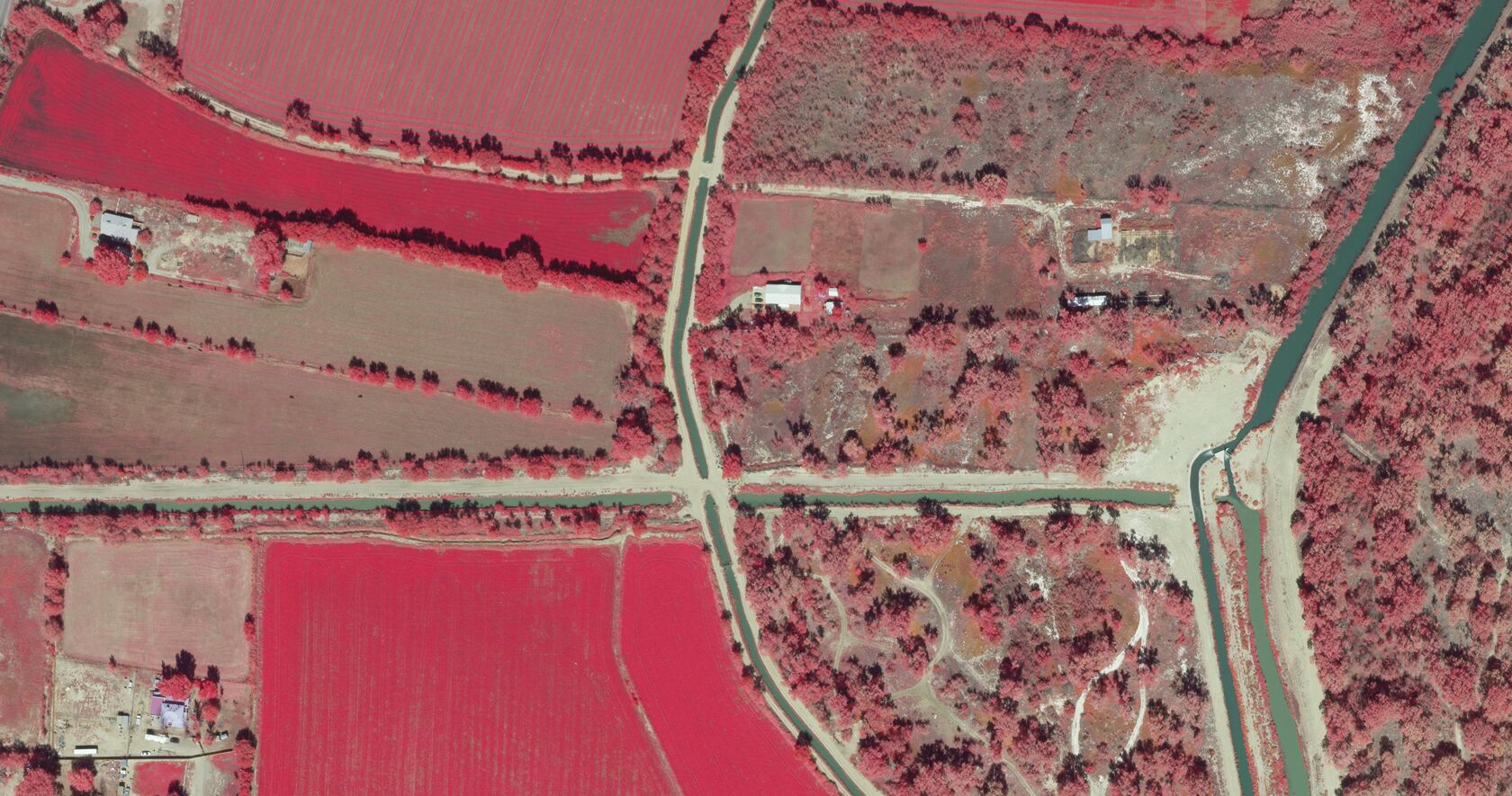
Sometimes speed and accuracy of imagery is vital to saving lives, property and the environment.
Discovery Air Fire Services (DAFS) is a premier provider of special-mission aircraft working in the field of fire services, in Ontario, Canada, has an Imaging Division that provides low-level infrared services with its Hawkeye Units and high-level infrared with its Eagleye Units.
Not long ago, DAFS sought to develop a highlevel aerial infrared imaging service that could be operated from a low cost aerial platform. The system would provide accurate thermal and visual imagery, which can be used to effectively map and fight wildfires. The camera uses bolometer technology which does not require cooling like other IR cameras. GPS data accompanies every image for projection onto flat topographic or 3D terrain maps.
DAFS selected the NovAtel SPAN-SE and IMU-CPT on its FireMapper sensor to connect with an RGB thermal camera to produce near real-time orthophotogrammetric photos.
Kathofer says, “Crews must process the imagery as quickly as possible. In this case, the challenge was to synchronize the FireMapper sensors to the GPS/IMU axis. As with any customer, the goal is to find the most suitable GPS/IMU for the purpose, in terms of accuracy and price.”
He concludes, “That's the beauty of the NovAtel family of GPS/IMU products-flexibility. Within their GPS/IMU navigation product line, I can find a solution that fits the lower-end UAV small format cameras to higher end large format systems.”